Thursday, April 17, 2014

Arizona to New Mexico

Here it is April already. Debi and I are trying something new this year. As most of you know, this is our fifth year of full time traveling. We've enjoyed our travels, having been through and visited 42 States so far. We still have the New England States to visit. That said, last year we spent several weeks at the Bella Terra RV Resort in the Gulf Shores area of Alabama. While there we were asked if we would be interested in doing some work kamping. That is, working around the resort in exchange for our space rent and utilities. We had never done that before but it sounded easy and interesting. The fact we also loved the area helped a lot, so we decided to try it this year. We left Mesa mid March and headed east to Alabama. Since there's not much to see along this route, my intention is to gloss over some of the area as we didn't spend much time there as we visited the same places several times in the past couple years. Given our 3 hour travel window limits us as to which campgrounds we'd like to visit. We did try several new ones so they will be somewhat featured here. Enjoy.....Dennis


Welcome to New Mexico, goodbye Arizona.


About half way between Lordsburg New Mexico and Deming, we passed the Continental Divide. From this point in New Mexico, all waters falling to the west flow into the Pacific Ocean and all waters east of it flow to the Atlantic Ocean. The Great Divide starts in Seward Peninsula in Alaska and extends to the tip of South America.


We turned off Interstate 10 and headed north east into Las Cruces, New Mexico. As we crested the hill, we could see the City below nestled in a basin below the towering mountains.


We finally stopped for the night at the Hacienda RV Resort. Wide spacious sites awaited us. I was pretty tired even though it was only a three hour drive. The dreaded "Check Engine" light on the dash decided to illuminate causing me some distress. Fortunately, there is a Cummins dealer in San Antonio. I'll have it checked there.


After spending a couple days at the Hacienda RV Resort we headed east once again. We hoped to arrive in Junction before the sunset. Our destination is the North LLano RV park, formerly a KOA.


El Paso, like so many border towns, appears to be a contradiction. On the west side of Interstate 10 lies the Mexican town of Juarez. On the east of the Interstate are upscale shops and stores.


The sign says it's the Gateway to Juarez but one has to simply look down from the Interstate to see the poverty below. They ask that you do not bring your firearms into their country.


We've visited Juarez in the past and found it typical to most of the border towns along the California, Arizona Texas border. Street vendors hawk their wares everyday along their sidewalks. We stayed the course this day and continued our journey.


Here you can see more poverty along the Mexican side of the freeway. Ciudad Juarez is a city of 1.5 million people and is considered Mexico's fastest growing city, despite being known as the most violent zone in the world outside war zones! Even though it appears pretty bleak from this vantage point, there are affluent areas within the City.


Leaving El Paso and heading east once more, we pass an abandoned RV left for Mother Nature to reclaim. It appeared to have been a home for someone but was now left to the coyotes and rattlesnakes.


Another abandoned RV. This Winnebago was way beyond being able to be saved. To think of when this was built and the dreams it provided for families as they traveled as we now do. It's sad in a way.


We left the valley floor and climbed up and over the small mountain range and arrived at a small campground along Interstate 10. In the past we have simply gone on to our next destination. However, this trip we decided to try a new campground. It turned out to be a real gem.


In the past we've stayed at Balmorhea State Park but this is the Saddleback Mountain RV Park which is right off I-10. For $10/night you get full hookups, a nature trail full of birds and butterflies, a service station, small store and a restaurant.


Monday, February 3, 2014

Laughlin, Nevada

Well here it is, a brand new year. After seeing our newest grandson on the West Coast, we decided to start off the new year with a stop at Laughlin, Nevada, which is located at the southern tip of Nevada. It's known for its' gambling, water sports and entertainment. It shares the Colorado River with Bullhead City, Arizona. We stayed at Don Laughlin's Riverside RV Park which we always do. The park was built in five phases and we enjoy the latest phase which sits above the city and has a nice view of the river and casinos. The rates aren't too bad either, especially if you gamble....


Some people hate the desert, some love it! I fall in the latter group, especially right after a rain when you can smell the sweet odor of the creosote bushes. Contrary to many beliefs, the desert isn't all hot and dusty. This is the high desert area which gets cool at night and at times is blanketed in snow!


Since we were coming from California, we took the River Rd. north from Needles. This road is not in the best condition and has many dips which may not be passable during times of heavy rain. We weren't too concerned with rain but I don't like abusing the coach.


Jasmine wants to know if we are there yet...she too, hates this road....


We finally arrive at Laughlin, arriving from the West. Across the river in the background is Bullhead City Arizona. There are several RV parks in the area, some have full hookups while others are dry camping only. The Riverside has a single parking lot for overnight guests but slides cannot be deployed. The RV park is right across the street.


This area of Nevada was largely ignored and visited by mostly miners that worked the nearby hills.

In 1964, while flying over the area, Don Laughlin, who owned a casino in Las Vegas, saw potential for tourism. He ended up purchasing a large portion of land along the Colorado River. Here he built a small casino with 12 slot machines, 2 live gaming tables and an 8 room "motel", although 4 of the rooms were occupied by Laughlin's family.


One of the area's favorites at the time was the casino's offering of all-you-can-eat chicken dinners for 98 cents. Don Laughlin wanted to call the new city, Riverside but the US Post Office liked the name Laughlin better, so that name stuck.

While the City of Laughlin has a population of only about 8,000, it's proximity to Bullhead City, Arizona, Fort Mojave, Arizona, Needles, California and Mojave Valley brings this area's population above 100,000.


Laughlin bills itself as a family oriented destination. Being along the Colorado River it offers much in water sports activities. A Riverwalk connects many of the casinos that line the river while riverboats take patrons up and down the river to the casinos. Shopping is abundant along the main thoroughfare including an outlet mall. A Sam's Club and Home Depot are just across the river, as is a major airport.


This picture, and the one's above were taken from our campsite at the Riverside RV Park.  While the RV Park is across the street from the Hotel/Resort shuttles run to take you down to the hotel and the "strip". There are several campgrounds within a short distance to the river and gambling but at $15/night with full hookups, we will always choose this park.


Leaving Laughlin heading east on Hwy 68 through Arizona, there is a large climb, 11 miles @ 6% grade. Near the summit this outcropping is aptly named "Finger Rock". If you travel this road, use caution after the summit. The road drops rapidly and the speed limit drops to 55MPH right when you enter the City of Golden Valley. It's a well documented area of zero tolerance enforcement, affectionately called a "speed trap". 


The climb up Hwy 68 is well worth the view from the summit.

Sunday, December 22, 2013

Balmorhea State Park, Texas

If you've driven across Texas and never stopped at Balmorhea State Park, you're missing out on a real gem within the Texas State Park system. When traveling across Texas in the past, we've always scooted right on by this section off I-10. Since we like to limit our days to 3 hour travel time, we usually go from Las Cruces NM, to Van Horn to Junction to San Antonio as there's not too much to see along this stretch of highway. This time, though, we decided to stay in Kerrville and travel to Balmorhea to Deming to Willcox Arizona. We were pleasantly surprised to find this State Park.  We had reservations and a State Park pass so check in was quick and painless. Full hook up sites are offered with pull thrus and back ins....


As I stated earlier, this part of Texas doesn't offer the traveler a very diverse view. Mostly desert type stuff for miles and miles.


There is some commercial ventures along this stretch as this picture shows. This is off I-10 near Fort Stockton, Texas.


This is part of the Texas hill country and the land does rise and fall allowing for beautiful vistas of the countryside below.


As you can see, this windmill was still in operation providing water for the many head of cattle grazing in the area.


As you travel westbound on I-10 around the area of Balmorhea Lake, take the Business Loop of I-10 and head southwesterly towards the City of Balmorhea...population  435, named for three landowners in the area...Balcum, Moore and Rhea.


Balmorhea State Park was built by the Civilian Conservation Corps in the early 1930s and opened to the public in 1968. It features a large, (1.75 acre) spring fed swimming pool complex. Water temp is a constant 72-76 degrees year round. They allow scuba diving in the pool and it is very popular due to it's pure clarity even at 25 feet. Besides camping, there is a metro style motel complex from the 1930s with a southwestern motif.


We chose a pull thru site which did not have a covered cabana. Many of the other pull thrus and most of the back ins did have a small covered area for bbqs and grills.


The sites are roomy and we didn't have to unhook the toad. Even though the campground was almost full, we didn't feel cramped. The evening produced millions of stars overhead and we felt like we could reach out and touch the milky way. It was an inspiring sight but it also made one feel pretty insignificant in the scheme of things.
The desert setting offers viewing of lots of wildlife including coyotes, deer, javelina, hawks, barn swallows, waterfowl, ground squirrels and my favorite, the roadrunner......."Beep beep"

Sunday, December 15, 2013

Kerrville, Texas

Due to poor weather conditions, we drove up and through San Antonio enroute to Kerrville, Texas. It just didn't make sense to travel the less busy secondary roads. Driving on a two lane road that's not as well maintained as the Interstate during inclement weather increases chances of an event we would prefer to avoid. The trip was pretty uneventful and I wasn't able to take any pictures...none that came out very well anyway. Kerrville was cold but the weather cleared up the day we arrived so we were happy campers again....


Coming into San Antonio, the weather was pretty glum. The four poster building is the AT&T Center, where the NBA San Antonio Spurs play basketball.


We arrived at the Buckhorn Lake RV Resort late afternoon under still gloomy skies.


The next day dawned clear but cold, so we decided to drive into Kerrville to look it over. After getting the car washed, we began our exploration.

No ! We couldn't change the weather,  but we did visit a Holiday Inn Express...


Why visit a Holiday Inn Express? Their swimming pool is constructed in the shape of the great State of Texas ! Unfortunately, it's upside down for those staying in the rooms. It is visible from the Interstate so I assume that's why they constructed it that way. Flip the picture over and you can easily see the State.


The Guadalupe River runs through the City of Kerrville.

Fall was definitely in the air. Looking down river you can see all the beautiful fall colors as the trees change and get ready for the cold days that are sure to follow.


Trees change colors and lose their leaves in the fall when the days become shorter. Leaves appear green due to an abundance of chlorophyll. This substance mask other colors in the leaves. Light regulates chlorophyll so when the days grow shorter, chlorophyll production slows. Other pigments in the leaves then take over which is why the leaves change colors.


We visited the "Cowboy Capital of the World"...Banderas Texas. This is the Bandera County Courthouse. It was added to the National Register of Historic Places on October 31, 1979.


As a tribute to Easter Island and Stonehenge, we found these monuments on the east side of Kerrville. The head is easily recognizable as a Moai.

Easter Island is a small island in the southeastern Pacific Ocean. It is the most remote inhabited island in the world. The nearest habitation is on Pitcairn Island, 1289 miles away!


Thanksgiving Day 2013.... 

Debi preparing turkey and trimmings while Jasmine enjoys her special dinner. 


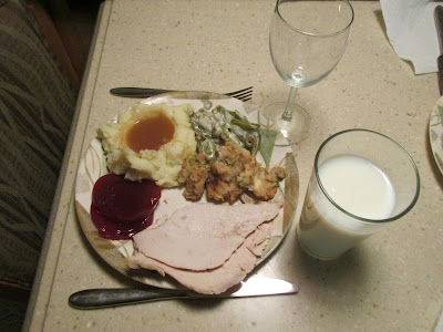
Living in a motor coach doesn't mean you can't have a delicious meal as evidenced here. After feasting on turkey, potatoes, green bean salad, cranberries and stuffing, we enjoyed pumpkin pie and whipped cream. Everything was cooked from scratch and was wonderful! I married an awesome chef....


Here's our site at Buckhorn Lake RV Resort. The resort is divided into several sections...the owner's section, a motor coach section, a long term stay section and a short term section. The sites were spacious with full hook ups.
It was nice to stop and enjoy the holiday here.

Friday, December 13, 2013

Lake Corpus Christi State Park

We had two routes we could take out of the Brownsville Texas area. We could follow the Mexican border into Laredo or head back east to Corpus Christi then north towards San Antonio. Weather was becoming a factor as cold temperatures were forecasted along with rain and possibly snow. With that in mind, we decided to head east, swing by Corpus Christi Lake then on to San Antonio and, if necessary, take I-10 west. 


Since we had taken US 77 south to Brownsville, we decided to go a different way back northeast, so we pulled off at Raymondville and headed north on Texas 186. Although a two lane highway, it was smooth and uncrowded.


Once we joined US 281, we headed east toward Corpus Christi. US 281 is a divided highway. Very nice alternative to the Interstate system.


Just outside FalFurrias, Texas, the US Border Patrol has a checkpoint. It was pretty busy and delayed us about 15 minutes. They waived us through with no problems. As you can see, almost 3100 illegals picked up at this checkpoint.


The area along this stretch of US 281 consists of mostly small farms and some cattle with only a few oil wells.


Lake Finley, Alice, Texas, offers excellent fishing. It was constructed in 1965 by damming up the river to provide recreational opportunities.


Mathis, Texas....population 5034.


Spotted this big boy wandering near Texas 359 just before the campground. I tried to get a better picture but with him moving and my driving, this was the best I could do. He certainly had a beautiful rack.


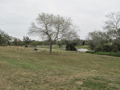
We finally reached our destination, Lake Corpus Christi State Park. We purchased the annual Texas State Park Pass. Without it, there is a daily per person fee to use their parks and facilities. 


The State Park consists of 288 acres surrounding the Corpus Christi Lake. There are three campgrounds but only one has full hookups with pull through sites. Most overlook the water. Bath houses have showers and flush toilets.


Despite this area of Texas experiencing drought conditions, we found the lake almost full. There are several picnic areas all around the lake. Fishing is good for largemouth bass, crappie and catfish. There are two fishing piers. No fishing license is required at any of the Texas State Parks.


This is the view out our doorway. If you look across the green area, you can see our coach. All sites in this section are pull throughs with full hookups.
Next to our car, you can see my American flag. Next to the flag is a covered cabana for your BBQ.