Sunday, December 22, 2013

Balmorhea State Park, Texas

If you've driven across Texas and never stopped at Balmorhea State Park, you're missing out on a real gem within the Texas State Park system. When traveling across Texas in the past, we've always scooted right on by this section off I-10. Since we like to limit our days to 3 hour travel time, we usually go from Las Cruces NM, to Van Horn to Junction to San Antonio as there's not too much to see along this stretch of highway. This time, though, we decided to stay in Kerrville and travel to Balmorhea to Deming to Willcox Arizona. We were pleasantly surprised to find this State Park.  We had reservations and a State Park pass so check in was quick and painless. Full hook up sites are offered with pull thrus and back ins....


As I stated earlier, this part of Texas doesn't offer the traveler a very diverse view. Mostly desert type stuff for miles and miles.


There is some commercial ventures along this stretch as this picture shows. This is off I-10 near Fort Stockton, Texas.


This is part of the Texas hill country and the land does rise and fall allowing for beautiful vistas of the countryside below.


As you can see, this windmill was still in operation providing water for the many head of cattle grazing in the area.


As you travel westbound on I-10 around the area of Balmorhea Lake, take the Business Loop of I-10 and head southwesterly towards the City of Balmorhea...population  435, named for three landowners in the area...Balcum, Moore and Rhea.


Balmorhea State Park was built by the Civilian Conservation Corps in the early 1930s and opened to the public in 1968. It features a large, (1.75 acre) spring fed swimming pool complex. Water temp is a constant 72-76 degrees year round. They allow scuba diving in the pool and it is very popular due to it's pure clarity even at 25 feet. Besides camping, there is a metro style motel complex from the 1930s with a southwestern motif.


We chose a pull thru site which did not have a covered cabana. Many of the other pull thrus and most of the back ins did have a small covered area for bbqs and grills.


The sites are roomy and we didn't have to unhook the toad. Even though the campground was almost full, we didn't feel cramped. The evening produced millions of stars overhead and we felt like we could reach out and touch the milky way. It was an inspiring sight but it also made one feel pretty insignificant in the scheme of things.
The desert setting offers viewing of lots of wildlife including coyotes, deer, javelina, hawks, barn swallows, waterfowl, ground squirrels and my favorite, the roadrunner......."Beep beep"

Sunday, December 15, 2013

Kerrville, Texas

Due to poor weather conditions, we drove up and through San Antonio enroute to Kerrville, Texas. It just didn't make sense to travel the less busy secondary roads. Driving on a two lane road that's not as well maintained as the Interstate during inclement weather increases chances of an event we would prefer to avoid. The trip was pretty uneventful and I wasn't able to take any pictures...none that came out very well anyway. Kerrville was cold but the weather cleared up the day we arrived so we were happy campers again....


Coming into San Antonio, the weather was pretty glum. The four poster building is the AT&T Center, where the NBA San Antonio Spurs play basketball.


We arrived at the Buckhorn Lake RV Resort late afternoon under still gloomy skies.


The next day dawned clear but cold, so we decided to drive into Kerrville to look it over. After getting the car washed, we began our exploration.

No ! We couldn't change the weather,  but we did visit a Holiday Inn Express...


Why visit a Holiday Inn Express? Their swimming pool is constructed in the shape of the great State of Texas ! Unfortunately, it's upside down for those staying in the rooms. It is visible from the Interstate so I assume that's why they constructed it that way. Flip the picture over and you can easily see the State.


The Guadalupe River runs through the City of Kerrville.

Fall was definitely in the air. Looking down river you can see all the beautiful fall colors as the trees change and get ready for the cold days that are sure to follow.


Trees change colors and lose their leaves in the fall when the days become shorter. Leaves appear green due to an abundance of chlorophyll. This substance mask other colors in the leaves. Light regulates chlorophyll so when the days grow shorter, chlorophyll production slows. Other pigments in the leaves then take over which is why the leaves change colors.


We visited the "Cowboy Capital of the World"...Banderas Texas. This is the Bandera County Courthouse. It was added to the National Register of Historic Places on October 31, 1979.


As a tribute to Easter Island and Stonehenge, we found these monuments on the east side of Kerrville. The head is easily recognizable as a Moai.

Easter Island is a small island in the southeastern Pacific Ocean. It is the most remote inhabited island in the world. The nearest habitation is on Pitcairn Island, 1289 miles away!


Thanksgiving Day 2013.... 

Debi preparing turkey and trimmings while Jasmine enjoys her special dinner. 


Living in a motor coach doesn't mean you can't have a delicious meal as evidenced here. After feasting on turkey, potatoes, green bean salad, cranberries and stuffing, we enjoyed pumpkin pie and whipped cream. Everything was cooked from scratch and was wonderful! I married an awesome chef....


Here's our site at Buckhorn Lake RV Resort. The resort is divided into several sections...the owner's section, a motor coach section, a long term stay section and a short term section. The sites were spacious with full hook ups.
It was nice to stop and enjoy the holiday here.

Friday, December 13, 2013

Lake Corpus Christi State Park

We had two routes we could take out of the Brownsville Texas area. We could follow the Mexican border into Laredo or head back east to Corpus Christi then north towards San Antonio. Weather was becoming a factor as cold temperatures were forecasted along with rain and possibly snow. With that in mind, we decided to head east, swing by Corpus Christi Lake then on to San Antonio and, if necessary, take I-10 west. 


Since we had taken US 77 south to Brownsville, we decided to go a different way back northeast, so we pulled off at Raymondville and headed north on Texas 186. Although a two lane highway, it was smooth and uncrowded.


Once we joined US 281, we headed east toward Corpus Christi. US 281 is a divided highway. Very nice alternative to the Interstate system.


Just outside FalFurrias, Texas, the US Border Patrol has a checkpoint. It was pretty busy and delayed us about 15 minutes. They waived us through with no problems. As you can see, almost 3100 illegals picked up at this checkpoint.


The area along this stretch of US 281 consists of mostly small farms and some cattle with only a few oil wells.


Lake Finley, Alice, Texas, offers excellent fishing. It was constructed in 1965 by damming up the river to provide recreational opportunities.


Mathis, Texas....population 5034.


Spotted this big boy wandering near Texas 359 just before the campground. I tried to get a better picture but with him moving and my driving, this was the best I could do. He certainly had a beautiful rack.


We finally reached our destination, Lake Corpus Christi State Park. We purchased the annual Texas State Park Pass. Without it, there is a daily per person fee to use their parks and facilities. 


The State Park consists of 288 acres surrounding the Corpus Christi Lake. There are three campgrounds but only one has full hookups with pull through sites. Most overlook the water. Bath houses have showers and flush toilets.


Despite this area of Texas experiencing drought conditions, we found the lake almost full. There are several picnic areas all around the lake. Fishing is good for largemouth bass, crappie and catfish. There are two fishing piers. No fishing license is required at any of the Texas State Parks.


This is the view out our doorway. If you look across the green area, you can see our coach. All sites in this section are pull throughs with full hookups.
Next to our car, you can see my American flag. Next to the flag is a covered cabana for your BBQ.

Thursday, November 28, 2013

To the Southern Tip of Texas

Brownsville and McAllen are known as the southern most cities in Texas. Los Ebanos is actually the furthest and is a small border town between Texas and Mexico. We headed into Los Ebanos to take the hand drawn ferry, the only one of it's kind on the U.S. border. As our luck would have it, we arrived at 3:45PM and the ferry stops at 4PM. Not wanting to get stuck on the wrong side of the border, I snapped some pictures, spoke at length to the border guards and stayed on our side of the Rio Grande....


As we headed towards the border, this fella pulled in front of us. We decided to allow him to go ahead and were content to follow...at a very great distance. His cab was packed with televisions an tons of other "stuff". It was hard to see how he could even drive. Scary!


We were amazed at the number of flowers in this cemetery. Almost every gravesite had flowers and it was very well groomed. This was in contrast to the neighboring homes which were extremely run down.


As we approached the ferry landing, this sign caught our eye. It offered free information about the ferry, clean rest rooms and ice cream and candy. I'm pretty sure the store was closed.....see below.


This is the American side of the Rio Grande River. Even though this is a hand drawn ferry, make no mistake, this is a border crossing. The ferry can hold up to three cars at a time. The crossing utilizes the same protocol as any border other crossing, with inspections, dogs and passport requirements.


The ferry is a 44 foot long wooden barge and is pulled across the Rio Grande with ropes attached to a cable system. It is the only ferry in the world between two countries that uses human power.  The ferry is pulled by six very strong men. The toll is 50 cents for walk ons and $2/per vehicle. The men who work the ferry get paid only $1/hour.


Here's the "store" offering ice cream and candy. What do you think? We didn't dare see if it was open or not.


The City of Hildalgo really goes all out in the Celebration of Christmas. They were setting up decorations all around the City offices.


Even "Angry Birds" got into the spirit. Wishing all a Merry Christmas.


The City of Hidalgo boasts the World's Largest Killer Bee. It stands as a reminder of that day in 1990 when the first "Africanized Honey Bee" crossed the border and entered the United States.

These bees are very aggressive and seem to attack the head area which has resulted in the most deaths due to stings. 

The first attack by these bees occurred in 1991 in Brownsville, Texas. The first fatality was reported in 1993 in Harlingen, Texas.


Hildalgo's mayor decided to proclaim Hildalgo the "Killer Bee Capital of the World" and convinced the City to allocate $20,000 towards the construction of the killer bee statue. During the Christmas parade, the bee is removed from it's place in the park and paraded down main street.

How big is this statue? I wasn't able to find any information other than it was commissioned and constructed by an artist from Wisconsin.
 Since I couldn't get the information about the sculpture's size, I used Debi and Jasmine as props.


Wednesday, November 27, 2013

South Padre Island, Texas

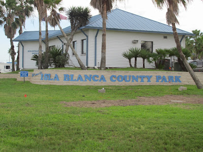
One of the reasons we wanted to go to the Rio Grande Valley was to visit South Padre Island. There was so much hype, we wanted to visit and see what it had to offer. We were a little disappointed. While it's certainly a beautiful place, we thought it was a bit over rated. We were there on a Friday night and we both felt like there just was no energy. Sure, there are hotels, restaurants and many gift shops but the energy wasn't there. I guess we expected something like downtown Chicago or New Orleans but it just wasn't there. In fairness, I'm sure during the summer and/or Spring Break it's a hopping place. We could see that. The KOA was a nice park but old and certainly not secure. We would probably choose the Isla Blanca Park if we were to stay there....


Enroute to South Padre Island, we spotted Bobz World. Bob has a jungle theme crossed with dinosaurs and sea shells. Pretty weird.


The dinosaurs were lifelike though and well done. This big guy was being harassed by three smaller stegosauruses.


Besides the dinosaurs and the jungle theme, you can see the huge sea shell in the background with these dolphins jumping out of the water.


King Kong kept a close eye on us while we were in the parking lot.


Bobz World, of course, sells souvenirs, t-shirts, shells and other touristy items. But, you had to dodge this awesome shark to get inside.


After scoring some t-shirts, we bid King Kong adieu and headed down toward Port Isabel and South Padre.


Welcome sign to Port Isabel.


This ship with attached mermaid actually is the entrance to a liquor store. Certainly an eye catcher and interesting architecture.


The Port Isabel lighthouse, built in 1852, is still standing today. It was in use until 1905 at which time it was abandoned. It sat empty until 1927 when the Federal Government sold the lighthouse and land to a local citizen. In the 40's a movement was started to save the lighthouse as a historic site. On October 5, 1950 the Texas State Park Board accepted the lighthouse and land as a gift. Restoration began and the lighthouse was opened to the public in 1952.


Along the boardwalk, just east of the lighthouse is a restaurant, bar and gift shop. Although the restaurant sports a pirate theme, the bar features what is claimed to be the "Worlds Largest Fishing Pole".


"Black Jack" keeps watch over the entrance to his galley, saloon and gift shop.


Port Isabel is a working deep water port. Originally used for the exportation of cotton, today it is used primarily to lower transportation cost focusing on offshore oil and gas industries.


We decided to spend some time on the beach and found it pretty empty. While many hotels line the beachfront, we saw several that were boarded up. It's possible they were damaged so severely during the hurricane of 2008 that the cost to make them habitable again was too great.


As tempting as the water was, I decided to forego anything more than wading due to the presence of a large amount of  Portuguese Man O' War  found on the beach.


Here's a Portuguese Man O' War. These creatures are not really jellyfish but float and feed in a similar fashion. The difference between these and the ones we saw at Goose Island, is these guys produce a powerful sting from their tentacles. The large sac you see here can be inflated or deflated depending on it's needs.
 
The sac inflates to allow it to float on the surface while letting the tentacles to float underneath. The tentacles can grow as long as 33 feet! Any of them release a powerful venom that paralyzes their prey before being brought up to it's body. 

The Man O' War is not a single organism but rather a colonial organism of many small individuals called zooids.

The sting from one of it's many tentacles can be extremely painful so I decided today was not the day for swimming.