Thursday, October 4, 2018

Exotic places while traveling full time

We are in our tenth year full timing and still enjoying every minute of our time together. There are so many beautiful and forgotten places in this country. As most of you know, we don't like traveling on the Interstates and prefer the adventures you'll find on the back roads. Furthermore, once we arrive at a location, we use the car to explore those places that are not accessible with our coach. We came into Arkansas on US64, a two lane relaxing road, so once we settled into our campsite we decided to explore the area. 


Interstates are ok if you need to get from Point A to Point B quickly.  But, if you're not in a hurry, most of the US highways are perfect to enjoy the journey. You'll find many forgotten towns and little gems. This is US 64 towards Ozark, Arkansas. It is a great alternative to I 40. You'll arrive at your destination much more relaxed and see things that you'd otherwise miss.


I told my wife I'd take her to exotic places and here's one. Now she can't say I never took her to Paris! It's claim to fame is it's the gateway to Mt. Magazine which boasts the highest point in Arkansas. Incorporated in 1879, the population is now 3300. It was named after it's French counterpart. Originally a coal mining community, today it's main industry is farming and ranching but it also is home to manufacturing plants serving the auto and aerospace industries.


The highway leading into Paris. Of note is Paris was the site of the last execution by hanging in the State of Arkansas in 1914. John Arthur Tillman was hanged for the murder of his girlfriend Amanda Stephens. The gallows were replaced by the electric chair after the hanging. The jail where Tillman was held and hanged still stands today and is the Logan County Museum.


Entry from the west. The Logan County museum is on the left and further down is the County Courthouse.


The Logan County Courthouse was built in 1908 out of brick set on a cut rock foundation. It was placed on the National Register of Historical Places in 1976.

Every Christmas they have a parade through the city to the courthouse which is then lighted in spectacular fashion.

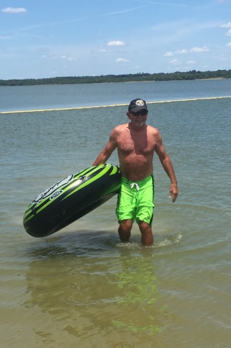
Cove Lake is a 160 acre lake off Arkansas 309 south of Paris. Popular activities include swimming, fishing, hiking, water skiing and scenic drives. A boat ramp is available and an on-site concessionaire provides boat rentals and other equipment available for purchase.

The lake is home to catfish, large mouth bass, bluegill, sunfish, crappie and perch. It is stocked every other year, although a small amount of catfish are stocked annually and just prior to a yearly kids' fishing derby hosted at the lake.


After Paris, what could be more diverse than going on to Havana. Not too many people call this their home, but it's an interesting city. Poultry, farming and livestock make up it's industrial base. Although a very small city, it provides city water, sewer and trash service to its residents, as well as a Rural Fire Department with several pumper, tanker and brush fire trucks.


Main Street, Havana, Arkansas

Cloud formation over the Arkansas River at dusk.

Wednesday, October 3, 2018

Aux Arc Corps of Engineers Park

Leaving Oklahoma, we headed east into Arkansas. Our next stop was to be the Ozark-Jeta Taylor Lock and Dam on the Arkansas river just south of the town of Ozark, Arkansas. We arrived early afternoon under clear skies and warm weather. We selected the Aux Arc Corps of Engineers Park situated along the banks of the Arkansas river across from the locks which allow barges and vessels to go up and down stream to deliver goods. Enjoy some pictures taken from the park. Areas around the park will be coming in my next segment. Look for it....Dennis


Our site at Aux Arc COE. Aux Arc is French. A name that originated with French explorers when they first mapped and explored the Arkansas river and adjacent area. Loosely translated, it means "top of the arc" referring to the large bend in the Arkansas river here. These words were eventually morphed into what we call "Ozarks" today.


The COE park has water and electric at each site. Some sites are only 30 amp but the majority have 50 amp. There are two dump sites available. The sites are situated on the river side and inland side. Fortunately, ours was alongside the Arkansas river. The sites were large and spacious. Due to the abundance of trees we could not use our roof mounted satellite dish so we had to put up the remote dish. Not too big a deal but worth mentioning. If you're offended by train noise, this probably is not the campground for you, as the tracks are right across the river.


This is a view from the back of our site. The Arkansas river makes a huge bend here with the town of Ozark, Arkansas at the apex. The river is so wide here that this area is referred to as Ozark Lake. In the distance is the railroad bridge and while I never counted, I'd estimate about 14 trains use these tracks daily. Fishing along the banks was excellent. The park also offers a very large play area for the kids.


For those not familiar with the Army Corps of Engineers, it is a federal agency that employs about 37,000 civilian and military personnel. It was established on June 11, 1775. Yes, it's 243 years old! The corps' mission is to "Deliver vital public and military engineering services; partnering in peace and war to strengthen our Nation's security, energize the economy and reduce risks from disasters." Most of their work is preventing maritime disasters and maintaining flood control and waterway navigation.


If you look closely at this picture, just below and to the right of the bridge, you can see one of the freight trains. There are several unprotected and protected crossings along these tracks. While they run across the river from the campground, the trains are required to sound their horns as they pass these crossings. Obviously, they can be heard from your campsite. Since we enjoy trains, we didn't find them disruptive.


This park is one example of the corps byproducts of flood control and waterway navigation. All locks and dams along major rivers in the United States are run by USACE.

Here, you can see the dam and the adjacent locks in the foreground. The large concrete facility at the far end is at the entrance to the campground. 


Since the Arkansas river is used to move cargo to ports up and down stream, there has to be a device that allows them to pass the dams. This is where the locks come into play. Simply put, a lock is a huge passageway that is sealed on both ends. When a cargo barge approaches, one end opens and allows the ship to proceed into the passageway. That end is then closed. If the river is higher at the far side of the dam, then the passageway fills with water raising the ship to the level of the far side.


Here is one of the large boats that push the barges up and down the river. These boats, referred to as 'towboats', have engines ranging from 600-11,000HP. Here, on the Arkansas river, they are limited to 5,000HP and generally push 16 barges at a time. Each barge is typically about 200 feet long and 35 feet wide. A typical 'tow' would be 6-7 barges long and 5-6 barges wide.
The towboat pushes the barges into the lock to be allowed to proceed down the river.

Friday, September 21, 2018

Canadian Oklahoma Arrowhead State Park

We left Bardwell Lake and headed north into Oklahoma. Arrowhead State Park is located on the shores of Lake Eufaula, about 2 hours east of Oklahoma City in the small town of Canadian; Population 239. Most visitors come to this area engage in recreational activities, mostly boating and fishing, but the State Park includes an 18 hole golf course. Lake Eufaula is Oklahoma's largest lake with over 600 miles of shoreline. Every year fishing tournaments are held at the lake generating nationwide coverage. The Lodge at Lake Arrowhead State Park is owned and run by the Choctaw Indian Nation. Welcome to Oklahoma!


They say everything is bigger in Texas, but this awesome chair belongs to the Choctaw Nation and provides abundant seating for Jasmine and me.


We arrived at Arrowhead State Park. The on-site golf course is an 18 hole, par 72 course and includes a putting green, driving range and a full service pro shop. Green fees are $20 which includes the cart fee.


There are three different campgrounds at Arrowhead. We booked into the newest one which consisted of very large concrete pads and lots of room between them.  Our pad was almost 90'! I hadn't put out our slides yet as I wasn't sure exactly where I wanted to put the coach on the pad.


With a population just shy of 240 people, Canadian, Ok can be missed with a blink of the eye, so we decided to head to the 'big city', Fort Smith, Arkansas, which is on the border of Oklahoma and Arkansas. Located where the Arkansas and Poteau rivers combine, the City was established as a Fort in 1817. At the time, this area was a major hub for the Indians who used the river system for trading and transportation.


Due to it's location, almost dead center in the United States, Fort Smith became a well known for migrant settlers heading west. It was named after General Thomas Adams Smith, who interestingly never visited this town nor the fort that bears his name. Fort Smith was originally built to calm hostilities between the Cherokee and Osage Indian tribes.

Fort Smith was abandoned by Union troops at the outbreak of the Civil War in 1861. It was subsequently occupied by the Confederacy and saw it's share of battles.

Over 400 Confederate troops were killed and buried at Fort Smith. In 1863, the Union retook control of the fort. In 1897, the post cemetery became a National Cemetery when many of the casualties of nearby battlefields were exhumed and reinterred here. The cemetery includes over 1400 unmarked graves of both Union and Confederate troops. It also includes the grave of Isaac Parker, the "Hanging Judge"


Fort Smith was originally built in 1817 to keep peace between the Cherokee and Osage Indians. Only 7 short years later it was determined to be too far away from the newly defined Indian territory, Oklahoma. so it was abandoned in 1824. Three short years later, though, the troops returned as the fort was to be used as a clearing house for the Choctaw Indians as the Indians were forced to move westward into Indian territory. As the federal government continued forcing the Indians westward, Fort Smith became a supply depot, both for troops who were stationed in the area and the Indians as they moved west. For the next 25 years, Fort Smith became the hub from which the Indians were relocated and supplies and ammunition for the troops were dispensed. In 1838 and 39, as part of President Jackson's Indian removal policy, Indians east of the Mississippi were forced to move west into what is now Oklahoma. This migration is now known as the "Trail of Tears" due to the devastating effect the migration proved to be on the Indian nations.


Earlier, I mentioned Judge Isaac Parker. Judge Parker is buried in the National Cemetery in Fort Smith.  During his tenure on the bench, Judge Parker presided over 13,490 cases. Of these, slightly over 8,500 defendants either pled or were found guilty of their crimes. Parker sentenced 160 people to their death; 79 were executed earning Judge Parker the nickname of the "Hanging Judge" These are the actual gallows where many of these criminals spent their last few seconds on earth.


Here, and the picture below, you can see the Arkansas river as it flows through the Fort Smith area. The Arkansas river was important in the settling of this area of the country. It was used for transportation of supplies and goods into Fort Smith to be sent to the surrounding communities and areas. This section is located on the west portion of Fort Smith near where the Trail of Tears ends. From here, the Indians were assigned their new homes in what is now present day Oklahoma.


Saturday, September 8, 2018

Bardwell Texas and Vicinity

Once we settle in at a place, we like to take some time and visit the surrounding area. Bardwell is a very small town in Texas so we went north to Waxahachie and south to Corsicana. Both towns offered a glimpse into the past and also provided some shopping centers so we could re-stock our pantry. Here are a few photos of these areas.


Not everything is oversized in Texas! Bardwell, Texas is a small farming community of only 649 hearty souls. Mostly cotton farming with some grain mixed in. This is their City Hall. The town was founded in 1880 by John Bardwell who saw the potential for cotton growing and brought the first cotton gin to the area.


In the early 1900s, Bardwell prospered with three cotton gins and six grocery stores. It had it's own telephone and electricity system. However, the main road through town was abandoned with the construction of State Hwy 34 and many of the businesses closed. Today there is only a small convenience market and a gas station. The post office, formed in 1894 remains. This is the Police Station.


A short drive south of Bardwell Lake takes you to Corsicana Texas, population 25,000. This bustling community was founded in 1848 and is about an hour south of Dallas. The town gained notoriety when prospectors trying to find water, discovered oil instead. It was the first commercially significant oil field in Texas.


Old town Corsicana is home to Collin Street Bakery, making fruitcakes and shipping worldwide since 1896. Wolf Brand Chili is also made here. Major shopping includes The Home Depot, Harbor Freight Tools, WalMart and Kohls. In fact, Kohls main warehouse is located just outside town.


We love old churches. This one at 398 N 15th St. was built in 1896 and the steeple was the tallest structure in town until the mid 1960s. The middle steeple, which is actually a spire, was damaged beyond repair and had to be completely replaced in 2016. The church is the First United Methodist Church. 


Our third day at Bardwell Lake turned out to be overcast with a chance of rain showers. We thought we'd take advantage of that and head north for some shopping and sightseeing. Nice sunny days would be spent on the lake. I wanted to buy a couple spring floats for enjoying the lake and the local Target had some in stock. Waxahachie, Texas is just north of Bardwell Lake and about 35 minutes south of Dallas. The population is about 40,000. The town was founded in 1850 and incorporated in 1871. It is known as the Crepe Myrtle Capital of the world. 

After getting my spring floats, we headed into old town to check it out.


Since Waxahachie is the county seat of Ellis County, our first stop was the town square. As with most old towns, the county courthouse was centered in the middle of the town and many shops surrounded it to make the town square.  This is no longer done today. This is the Ellis County Courthouse. It is rated number 8 on the list of  outstanding architectural achievements in Texas. The original courthouse on this site was a log cabin, followed by a limestone 2 story structure. This building was built in 1897 and has been in use ever since.


Richard Ellis was a plantation owner, politician, and judge on the Fourth Circuit Court of Alabama. He moved to Texas in 1834 and became involved in politics there. He was a leader of a group that declared Texas' independence from Mexico and he signed the Texas Declaration of Independence. Later, Ellis served in the Texas legislature.  He died in 1846 at the age of 65. The statue which is located on the west side of the courthouse depicts him as if reading a speech. I rescued the American Flag that someone had carelessly tossed and placed it in his right hand to honor his dedication  and contributions to the Great State of Texas and to the United States.


Erected on the north side of the courthouse is a monument dedicated to the Confederate soldiers of the Civil War. Commissioned and paid for by the Daughters of the Confederacy, the monument stands as a reminder of those who sacrificed everything during our country's struggles in the mid 1800s. The inscription reads:
"IN HONOR OF THE DEAD AND LIVING OF ELLIS COUNTY, WHO WORE THE GRAY, BANNERS MAY BE FURLED, BUT HEROISM LIVES FOREVER. ERECTED BY THE DAUGHTERS OF THE CONFEDERACY, UNVEILED NOV. 2, 1912."


Surrounding the courthouse is the town square which consists of shops and restaurants. These town squares served as meeting places for the people living nearby. Much like the malls of today, people could take care of all their business in one place and catch up on all the latest news. Most of these buildings were built in the late 1800s and early 1900s.


Something we don't see enough of in today's high paced atmosphere. Pride in their town shows with this huge mural on one of the building walls in the town square. Waxahachie, pronounced, Woks-a-hotchee, is "A Place in Your Heart"

Finally, back at Bardwell Lake, looking west from our campsite, over a field of flowers at dusk

Monday, August 27, 2018

On the Road Again Lake Bardwell, Texas

We left San Antonio with it's heat and humidity and headed north hoping to catch some cooler weather. Our destination was Bardwell Lake; A Corps of Engineers Park outside Ennis, Texas. We like the COE parks as they are usually along a body of water, have at least partial hookups and many have 50amp service. 


I promised Debi I'd take her to romantic places. Being the romantic I am, here we arrive in Italy. Sorry, no leaning towers or Eiffel Towers, but romantic in it's own way. I also took her to Paris but I'll be posting that journey later.


In 1879, settlers found the soil in this area perfect for growing corn, sweet potatoes, cotton and wheat and a town was born. In 1890 the railroad made it to Italy and made it an important trade center. The year 2000 marked an important milestone. That year Italy documented it's 2000th resident. Italy encompasses 1.8 square miles, all of it land. It is located at the junction of US 77 and Texas 34.


Most everyone knows we don't like freeways and prefer back roads. Getting to Bardwell Lake was no different. Here is a sample of US 77 which leads through the center of Italy. By the way, locals pronounce it, It-Lee as opposed to It Al Lee. I think this is done with a lot of towns to identify out of towners.


Texas Hwy 34 runs northeast out of the town of Italy and meanders through fields of cotton, hay and some corn fields. Cotton fields dominated the landscape when we passed through.


As we entered the town of Bardwell we almost missed it because I blinked. The town of Howard is just north of here but we never found it. We explored this area and look for a future write up in the near future. The largest nearby towns include Ennis, with the largest Waxahatchie. I had our mail sent to us here via General Delivery. After driving to the post office I found it's only open 8am-12pm M-T.


Leaving Texas 34 the roads kept getting smaller and narrower, but we trudged on. The sign said "County Road ends in two miles", but GPS said this was the way, so off we went. Actually, I don't rely on GPS directions. I use Google Maps, view the route, then put in the coordinates so I know exactly where I'm going. The COE gatehouse was just ahead.


Our 'home' for the next two weeks. The weatherman called for rain for the next two days then promised great weather for the remainder of our stay. 

P.S. Don't rely on the weatherman.


Puffy clouds and a large lake welcomed us to the facility. Unfortunately the site I had picked and reserved turned out to be too unlevel for our coach. I had to nearly drop the nose on the ground to get level. Back to the gatehouse and the nice lady moved us to a better spot although it was across the street from the lake instead of directly on the lake itself.


Our new site was spacious, fairly level and within spitting distance of the lake and the swim area. Only issue was the tree seen in this picture. A couple of nasty Mockingbirds had built a next in it and they did not like Jasmine. She incurred their wrath every day. I had to stand next to her while doing her business otherwise she got dive bombed. 


The weather finally gave in and we had many beautiful days. This was the swim beach across from our site. I used the tube for a couple days before we went into Waxahatchie and bought a couple spring floats. Floating mindlessly on spring floats on a beautiful sunny day is my idea of paradise. The water was very warm but refreshing.


The day before we left, Mother Nature treated us to a spectacular rainbow. We never received any droplets but this rainbow over the lake was beautiful. I tried to get the full arc in one picture using both my camera and my phone but neither could get it all in.

That's it for tonight. I'll post pictures of the surrounding area in my next post.....D