Friday, September 12, 2014

South Through the Florida Keys

After arriving at John Pennekamp Coral Reef State Park, we settled in for our short stay. We tried to book a week but no sites were available for our size rig, so we had to improvise. We booked one site for four days then had to move across the road to another site for another four days. Kind of a pain, but there was a lot we wanted to do, so we took what was available. (Turned out our original site was only booked for ONE night by a single guy in a tent!) Anyway, we had a great time in the park. The beach was clean, the water dirty but warm..probably too warm. We got some snorkeling in, went on the glass bottom boat out to the reef and spent a day with the kayaks. Enjoyed several hikes around the park as well. Word of caution though....actually three words....mosquitoes, mosquitoes, mosquitoes......!


Once we turned off Hwy 1 onto the entrance road to John PenneKamp, I wasn't convinced we had made the right choice. After about 1/4 mile, this road widened and the we approached the guard shack, checked in and headed to our site.


Lots to do at Pennekamp

Snorkeling, canoeing, kayaking and just laying on the beach.  They have a gift shop, a marina, small store, bait shop, rental equipment and boat rides....glass bottom, fishing and snorkeling on one of the reefs.


 Many folks wonder if the Overseas Hwy, also known a US 1 is simply one long bridge. The answer is no...there are many bridges connecting the islands or keys as they're known but for the most part, Hwy 1 is like any other scenic road across America. It is, however, only one lane in each direction so you're pretty much at the mercy of the slowest vehicle.


We stopped at several beaches and tested the water. Most of it was clear but really warm.


These are just sample pictures taken along Hwy 1 south of Key Largo.


If you're looking for fresh crab, I'm sure this fellow would welcome you to his fish market and diner.


Besides snakes and alligators, Florida is home to many wild iguanas. The guy hung around our campsite for most of the time we were there. He was pretty tame and Jasmine wasn't too sure what to think.


He would come into our site and wander around every morning and evening. I think he sensed that I posed no threat and I kept Jasmine on a short leash so he wasn't harassed.
When not foraging for food, he lounged on one of the tree branches and watched the world go by.


Monday, September 8, 2014

Through the Everglades to Key Largo Florida

Leaving Ortona South, we headed over to La Belle and then south on Florida 29 through Immokalee. We had visited Naples earlier and going south on Hwy 29 saved us an hour or more getting to Key Largo. Hwy 29 dead ends at  US 41. From there we headed east through the Everglades and then south on US 1. Here are a few pictures from our journey.


Florida Hwy 29 is a small, uncrowded yet well paved road that provides a shortcut for those wanting to avoid the Interstates and Toll Roads.


The road cuts right through the Florida Panther Habitat. The Florida Panther is on the endangered species list. There are only about 100 known panthers in the wild, found only in southern Florida. Here are some quick panther facts:

Height: 23-27 inches at the shoulder for males; females are smaller.
Length: Males, 7 feet from nose to tip of tail; females, 6 feet
Weight: Males average 130 lbs; females 70-75 lbs
Lifespan: 10-15 years


Their diet consists of deer, wild hog, rabbits, raccoon armadillos and birds. A male cat needs about 200 square miles for it's home range while females only need about 75.

A litter usually consists of 1-4 kittens although rarely do all of them survive. The young will stay with their mother for up to two years.


Automobiles are known as one of the big cats most dangerous enemy. The State of Florida has erected 8' fences along the roadways in an attempt to prevent them from being struck and killed.


After passing through the Panther habitat, we entered the Big Cypress National Preserve.

Originally Big Cypress was intended to be part of the Everglades National Park but private landowners were not on board and it became it's own preserve later on. It is still occupied by several tribes of Indians, the Miccosukee, Seminole and Traditional people were provided with permanent rights to occupy and use the land in traditional ways.

Besides the Florida Panther, it is home to the Florida Bear, alligators, and venomous snakes, such as the Cottonmouth and the Diamondback Rattlesnake. It is also home to nine endangered species including the Indigo snake and the Florida Sandhill Crane.


Stop at any of the many tiki huts along US 41 and you can take a 90 minute air boat ride to see alligators in the wild. We spotted several gators alongside the road as we drove past the canals.

The Everglades is a complex system of interdependent ecosystems. It's actually a slow moving river, roughly 60 miles wide that move less than 1/2 per day. Sawgrass, marshes and sloughs dominate the area


After refueling at Flying J, we headed south through Homestead Florida. We were amazed at the proliferation of produce stands along the roadway.

Homestead is primarily a Miami suburb although less crowded. It is Florida's second oldest city and is home to Nascar's Homestead racetrack.


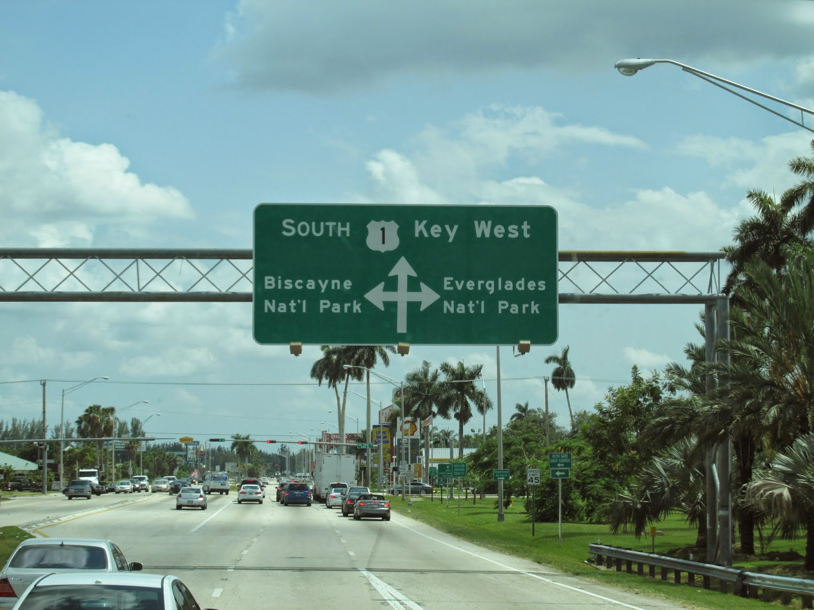
After leaving Homestead, we headed south on US 1. This highway serves the entire east coast stretching 2,369 miles from Fort Kent, Maine to Key West, Florida.  It was originally constructed in 1920. Today, most traffic flows on Interstate 95 which parallels US 1 but further inland. US 1 is the only highway, mostly single lane that traverses the Florida Keys.


Welcome to the City of Key Largo, also known as "Long Key". It is the first island of the Florida Keys and the originating point of the Overseas Highway to Key West, Florida.
John Pennekamp Coral Reef State Park. Time for exploration, kayaking and snorkeling.

Fort Myers/Punta Gorda and Naples Florida

We took a day trip starting with Punta Gorda then Fort Myers and ended with a wonderful dinner in Naples. We weren't too impressed with Punta Gorda,  so we continued on into Fort Myers. Originally settled as Fort Harvie in 1850 in response to continued raids by the Seminole Indians, it was later renamed Fort Myers. It served as a Union fort during the Civil War, before being abandoned in 1865. Naples, at the southwestern tip of Florida is home to upscale residences and businesses. 


Punta Gorda translated means "Fat Point". It's main claim to fame is that it was the end of a rail line that delivered its' main commodity, Phosphate. The city suffered massive destruction from Hurricane Charley in 2004 and since has undergone a rebuilding process.


Of note is this awesome sculpture by Peter "Wolf" Toth. It is one of 75 sculptures known as the Whispering Giants dedicated to Native Americans. Toth has created at least one sculpture in all 50 States. Florida has three. He never charges for his inspiring work.


Fort Myers consists of many beautiful and upscale buildings, a huge City owned marina and many parks.


If you look closely, you can see all the boats in the marina below these towers overlooking the Gulf of Mexico.


We finally made it south to Naples, one of the wealthiest cities in the United States. It boasts the sixth highest per capita income and the second highest proportion of millionaires in America.


Dolphins swim right alongside the Naples pier. Fishing off the pier is above average, and the area around the pier is noted for it's fine romantic dining.


This can be yours for a mere $40 million dollars. We'll keep our coach....

Monday, August 25, 2014

Ortona South COE, Lake Okeechobee Waterway, Florida

Our plan was to visit the Keys after Orlando. To do so, we didn't want to go there directly. That said, we stopped for a week in St. Lucie then headed west towards Fort Myers for a week before heading back towards the Keys. The Corps of Engineers has a park on the west side of Lake Okeechobee so that's where we headed. Rumor had it that this particular park was in the middle of nowhere but we thought that might be fun. Here are the pics....


Leaving St. Lucie, we headed west on Hwy 76, south on 98 and west on Hwy 80. We thought we would be able to see the Lake and anticipated driving around the perimeter of the lake later in the week. Unfortunately, there is a dirt berm that surrounds the Lake so it's not visible from the roadway.


There are very few cities along this route and I developed a small glitch with the coach. My warning light came on indicating water in the fuel. Water in a diesel is not a good thing. I had to stop twice to purge the system before I was able to extinguish it. We completed the trip with no further issues.


We passed many fields of sugar cane. I thought this sign was really appropriate.


Finally on Hwy 80, the road opened up and traffic moved well. You can see the dirt berm on the right of this picture. This berm surrounds the entire lake. Because the lake is very shallow, it's prone to major fluctuations during a hurricane. The City of Lake Okeechobee on the north shore has suffered major damage and loss of life, so they constructed the berm as a life saving measure.


Once we turned off Hwy 80 our road became somewhat narrower. I was glad there was no other traffic. Two 15 mph turns later, we were almost to the campground.


Ortona Lock Campground is on the Okeechobee waterway and is part of the same water system as the St. Lucie Lock and Dam. As such, one may only stay a total of 14 days total and any of the three campgrounds on the waterway. The front campground was open but the back one was closed for the season.


Checking in and getting our site assigned. All the sites on this end of the campground are on the waterway. Large spacious sites with ample room and lots of tropical vegetation.


This is a picture of the rear campground. The locks are on the left and a river runs on the right. Each site has 50amp service and water. There's a dump station as you exit. Each site is a waterfront site.


Shortly after setting up the coach, we had a rain shower come through. Originally this was a double rainbow but then it simply grew and became a complete arch. My camera's lens could not capture the entire arch but it went from ground to ground.


Taken at sunset from our site as the sun set in the west over the river canal. The fencing you see in the foreground is a fishing pier.


Another day, another sunset. I had to put down my fishing pole to take this picture. Just outside out coach.

Ahhh! Life is good!


While looking for a good place to fish I spotted this tortoise trying to get some sun. He stayed there for over an hour.


A Florida egret paid us a visit. I think he thought I was going to get all the fish. Ha Ha....silly bird....I got skunked!
We went out to dinner for our anniversary.  Perfect and Delicious!